Featured update
The strongest of several twisters to touch down in the southern part of the state in early May 2026 left a visible path of damaged vegetation.
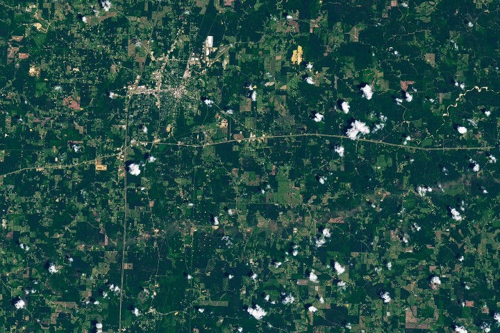
The strongest of several twisters to touch down in the southern part of the state in early May 2026 left a visible path of damaged vegetation.
Satellite imagery shows a surge of new volcanic activity in the ocean near Papua New Guinea.
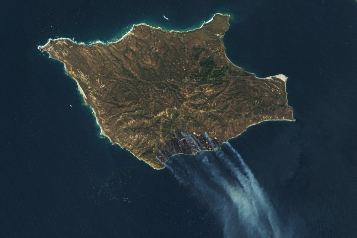
The blaze spread across the southern side of the second-largest island in California’s Channel Islands National Park.
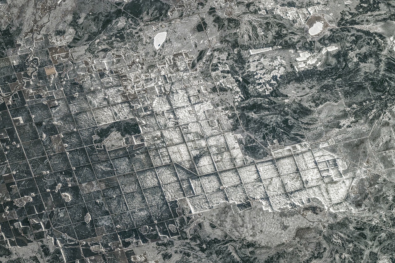
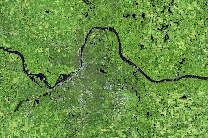
The glacial lake left a layer of silt and clay in southeastern Manitoba, creating fertile farmland that was divided during 19th-century land surveys and is still farmed today.
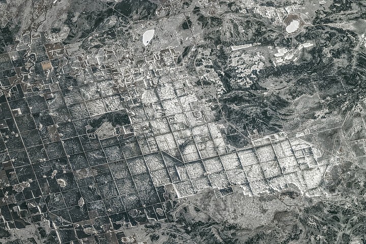
A recent analysis revealed where artificial light at night has intensified, as well as where it has diminished.

Spring melt along Alaska’s Kuskokwim River caused ice jams and flooding.

Beaver Island is one in a string of verdant and scenic jewels in a northern Lake Michigan archipelago.
Your challenge is to tell us the location of the satellite image and why it is interesting.
Near-constant activity continues on the volcano in Russia.

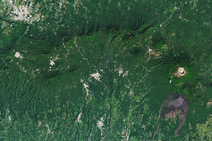
From a geothermal hotspot to the one-time “Lighthouse of the Pacific,” the heat is on beneath the volcanic landscape of western El Salvador.
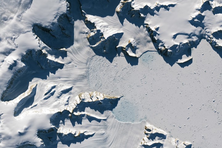
Scientists relied on satellite data to understand how the Antarctic glacier lost so much ice so rapidly.
Heavy rains from Tropical Cyclone Maila triggered a deadly landslide in the mountains of East New Britain.

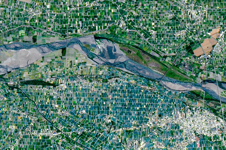
Diversity reigns across the farmland of Yunlin County in southwestern Taiwan—a region that produces an array of crops on small farms.
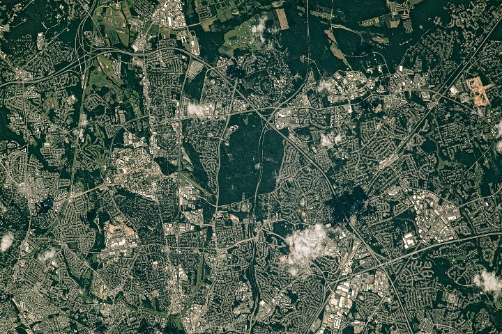
Along the northeast side of the Capital Beltway in Maryland, green spaces weave through the developed landscape.
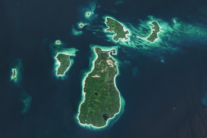
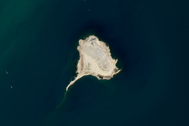
The tadpole-shaped islands along the Absheron Peninsula were born by explosive mud volcano eruptions and reshaped by erosion.
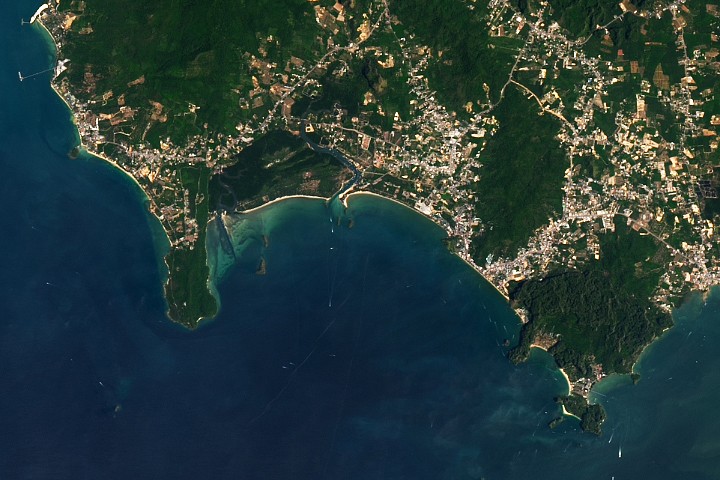
The coastal province features striking tropical karst landscapes and sandy beaches alongside a mix of natural land cover and developed areas.
Above-normal precipitation has swollen rivers and damaged infrastructure statewide.
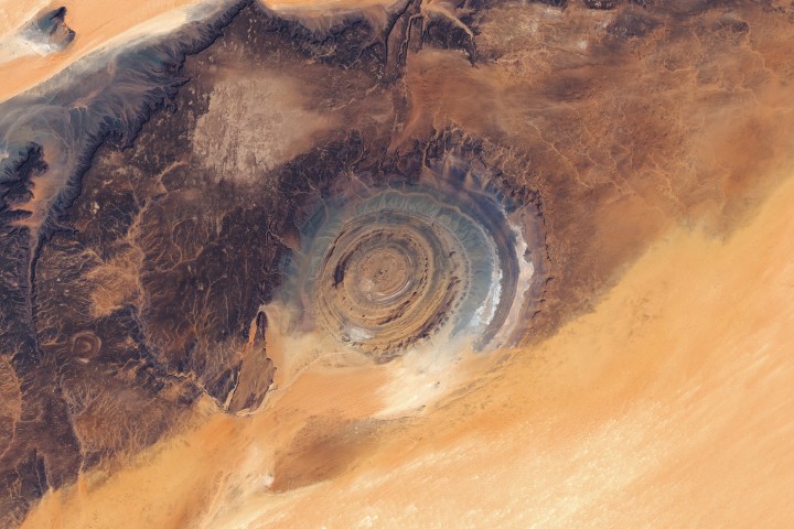
The circular geologic feature in northwestern Africa can be hard to recognize from the ground, but it is obvious when viewed from space.
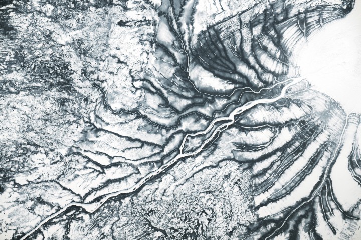
After the Laurentide Ice Sheet retreated from present-day Hudson Bay, rebounding land has revealed striking nearshore topography.
Your challenge is to tell us the location of the satellite image and why it is interesting.
