Featured update
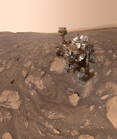
The agency’s six-wheeled geologist took a self-portrait during its survey of an ancient landscape that may predate the formation of Jezero Crater itself.
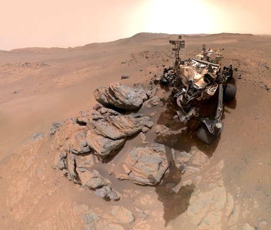
The agency’s six-wheeled geologist took a self-portrait during its survey of an ancient landscape that may predate the formation of Jezero Crater itself.
As part of a commercial partnership, the project is developing a sophisticated chip that will give spacecraft the processing capabilities to think for themselves.

The spacecraft is using the Red Planet’s gravity to increase speed and tilt its trajectory on the journey to the metal-rich asteroid Psyche.
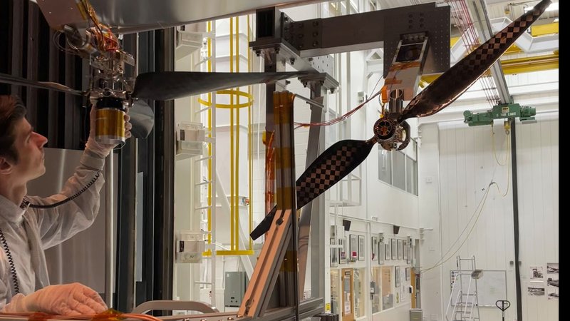
The faster a Mars helicopter’s rotors spin, the heavier the payloads it can transport and the farther it can fly.
A team of engineers and scientists are building NEO Surveyor to seek out the hardest-to-find asteroids and comets that could impact Earth.
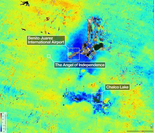
The NISAR satellite pinpointed areas of the city that are sinking by more than half an inch per month due in large part to groundwater pumping.
A novel electromagnetic thruster passed an initial test in a specialized chamber at JPL. With further development, these thrusters could support human missions to the Red Planet.

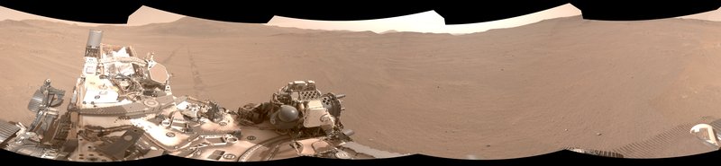
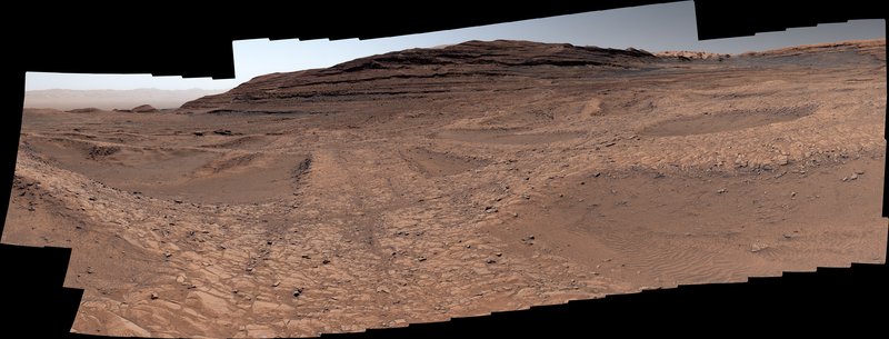
The two rovers captured scenes that highlight the different journeys they’re taking, helping to piece together the puzzle of the Red Planet’s past.
Seven organic molecules were identified for the first time on Mars, increasing our understanding of the kinds of molecular preservation possible on the Martian surface.
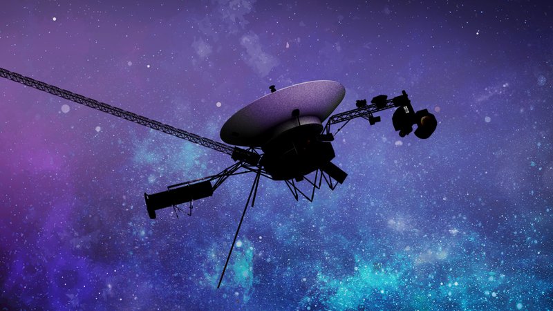
To conserve power, engineers at NASA’s Jet Propulsion Laboratory needed to turn off one of the science instruments on the most distant spacecraft ever built.
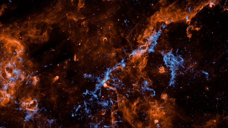
The water, carbon dioxide, and carbon monoxide ices are attached to the surface of tiny dust particles in clouds spanning hundreds of light-years across.
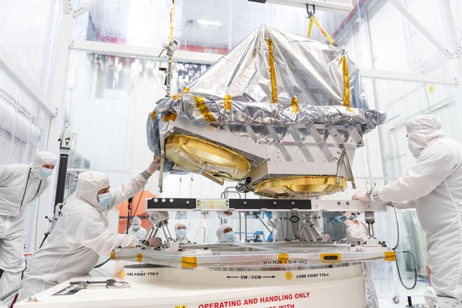
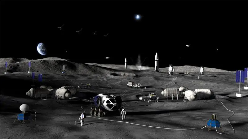
JPL will help support several of the agency’s initiatives to advance the nation’s leadership in space.
The Hybrid Observatory for Earth-like Exoplanets concept combines an orbiting starshade with a large ground-based telescope to image planets outside our solar system.
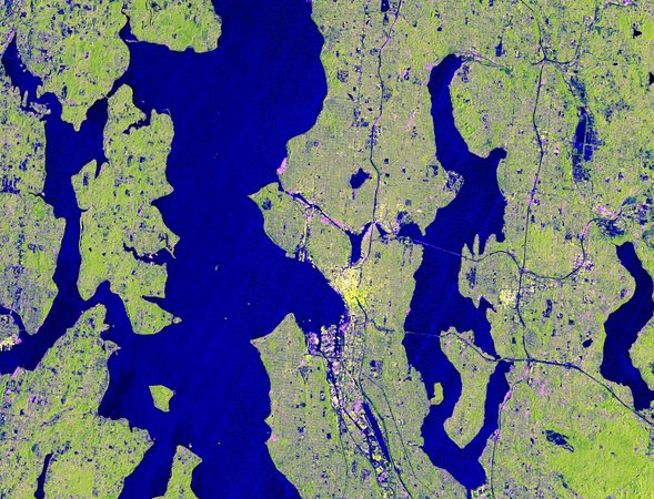
Seattle, Portland, Mount Ranier, and Mount Saint Helens are captured in new imagery from NISAR, the most powerful radar system ever launched by NASA or ISRO.
A new animation breaks down how JPL’s AI-supported hazard scout gets the drop on the ocean’s biggest waves.

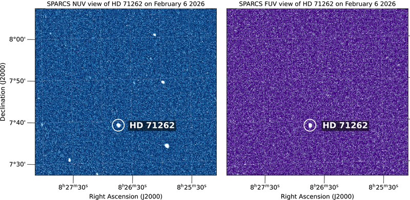
The SPARCS cube satellite is ready to begin studying low-mass stars and to reveal details about the habitability of the planets they host.
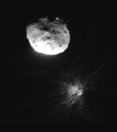
The spacecraft changed the binary system’s orbit, confirming that a kinetic impactor can be an effective planetary defense technique for deflecting a near-Earth object.
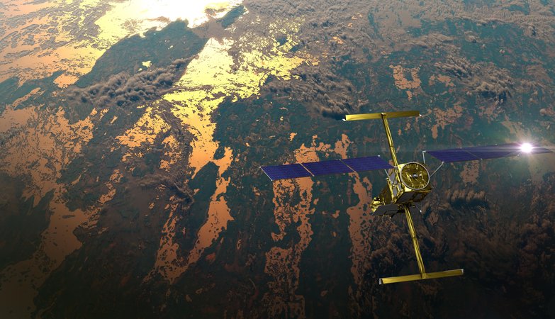
Rivers rise and fall throughout the year, but by how much? Perhaps less than previously thought, according to new data from the SWOT mission. Hidden riverbed contours are also emerging.
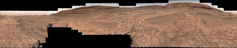
A hilly landscape that looks like spiderwebs when viewed from orbit holds clues to the history of water on ancient Mars.
There is no GPS at the Red Planet, but a new technology called Mars Global Localization lets Perseverance determine precisely where it is — without human help.